
Claremont is an incorporated city east of Conover in Catawba County. U.S. 70 runs through the community, and Interstate 40 is accessible near Exit 135. Claremont has its own City Council, planning and zoning, utilities, public safety, parks, and development process.
Gather, explore, and connect
Public spaces & community life
Claremont City Park
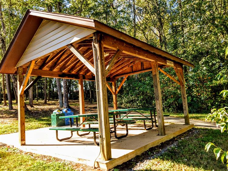
The park on East Main Street includes picnic shelters, play areas, a paved walking trail, an amphitheater, restrooms, and community-event space.
Explore City parks →Downtown & Social District
Claremont’s center includes civic buildings, local businesses, and a designated social district. Check the City’s current map, operating hours, and rules.
Visit the City website →Claremont Branch Library
The Catawba County Library branch provides books, technology access, educational programming, and community activities.
View library information →Regional access
I-40, U.S. 70, and nearby N.C. 16 connect Claremont with Conover, Hickory, Statesville, and surrounding rural areas. Test actual travel times from the property.
What’s happening
Current community calendars
Event dates change, so these live calendars are more useful than a static list.
Map & orientation
See the community in context.
Use this map for general orientation only. Confirm municipal limits, parcel boundaries, zoning, utilities, road maintenance, and school assignments through official sources. Map data © OpenStreetMap contributors.
Areas and property settings
Growth is occurring in more than one direction.
Claremont combines established residential streets, highway access, industrial employment, planned residential projects, and rural-edge properties.
Central Claremont
East Main Street and U.S. 70 connect City Hall, the library, park access, local businesses, and established residential streets.
I-40 & employment areas
Northern and eastern areas connect with major manufacturing facilities and planned industrial infrastructure. Review nearby uses and truck routes.
Residential growth areas
The City tracks approved and proposed subdivisions and townhome developments. Confirm project status, utilities, and construction phasing.
Rural edges
A Claremont mailing address can extend beyond the city. Larger parcels may involve county jurisdiction, wells, septic systems, easements, and different providers.
Featured local-development article
Claremont’s furniture economy is growing in a new direction
Coley’s planned $9 million expansion and 40-position commitment show how an existing local manufacturer can combine regional craftsmanship with a direct-to-consumer business model.
Featured local-development article
Prysmian and Claremont’s economic-development story
Prysmian’s announced expansion is an important employment, infrastructure, tax-base, housing-demand, and land-use story. Read the full analysis to understand what is planned, why the public process matters, and what prospective residents and property owners should watch.
Schools & jurisdiction
The mailing address does not answer every question.
School assignment
Claremont is within Catawba County Schools, but the assigned elementary, middle, and high schools must be confirmed for the exact address.
Who governs the property?
Property inside Claremont city limits is subject to City zoning, ordinances, municipal taxes, and service policies. A Claremont mailing address outside city limits may be governed by Catawba County instead.
Property-specific questions to verify
Confirm whether the parcel is inside Claremont city limits.
Verify water, sewer, stormwater, and utility capacity.
Review current development activity and nearby approved projects.
Check zoning, overlays, future land use, and industrial proximity.
For land, evaluate access, topography, septic, survey, and easements.
Confirm assigned schools directly with the district.
Official sources & planning links
City of ClaremontCurrent development activityCatawba County SchoolsCatawba County parcel mapExplore properties around Claremont
Search current listings, then let’s verify the jurisdiction, schools, utilities, land-use rules, and location details that matter to you.